

Geologic Setting
The Comoros volcanic archipelago grew on thin Cretaceous age oceanic crust in the heart of the Somali Basin — a setting that points to a working petroleum system, that’s at peak oil maturity today for oil and organically very rich.

Reeves, C.V. (2017). The development of the East African margin during Jurassic and Lower Cretaceous times: a perspective from global tectonics. Petroleum Geoscience, v. 24, pp. 41–56.
Built on thin oceanic crust.
Together with DSDP and ODP core-hole programmes, seismic reflection and refraction surveys proved that the Somali Basin — upon which the Comoros volcanic island archipelago grew — was floored by thin oceanic crust, not the continental crust found west of the Davie Fracture Zone in Mozambique Area 1. This ocean floor formed during seafloor spreading in the Late Jurassic to Aptian, as Madagascar and India moved 2,000 km southwards away from East Africa. The oldest sediments on the Comoros ocean floor are therefore Late Jurassic – Lower Cretaceous.
While Area 1 in Mozambique sits on continental crust and Area 4 straddles the Davie Fracture Zone, everything eastward is on oceanic crust — seen in the lower-frequency magnetic anomalies over continents versus oceanic crust, and in gravity and refraction results showing thin, shallow gabbro (7 km/s, ~10 km thick). The data show a shallow Moho at 8 km/s beneath the thin ocean crust, with fracture zones and transform faults.
An oceanic basement that reads like a barcode.
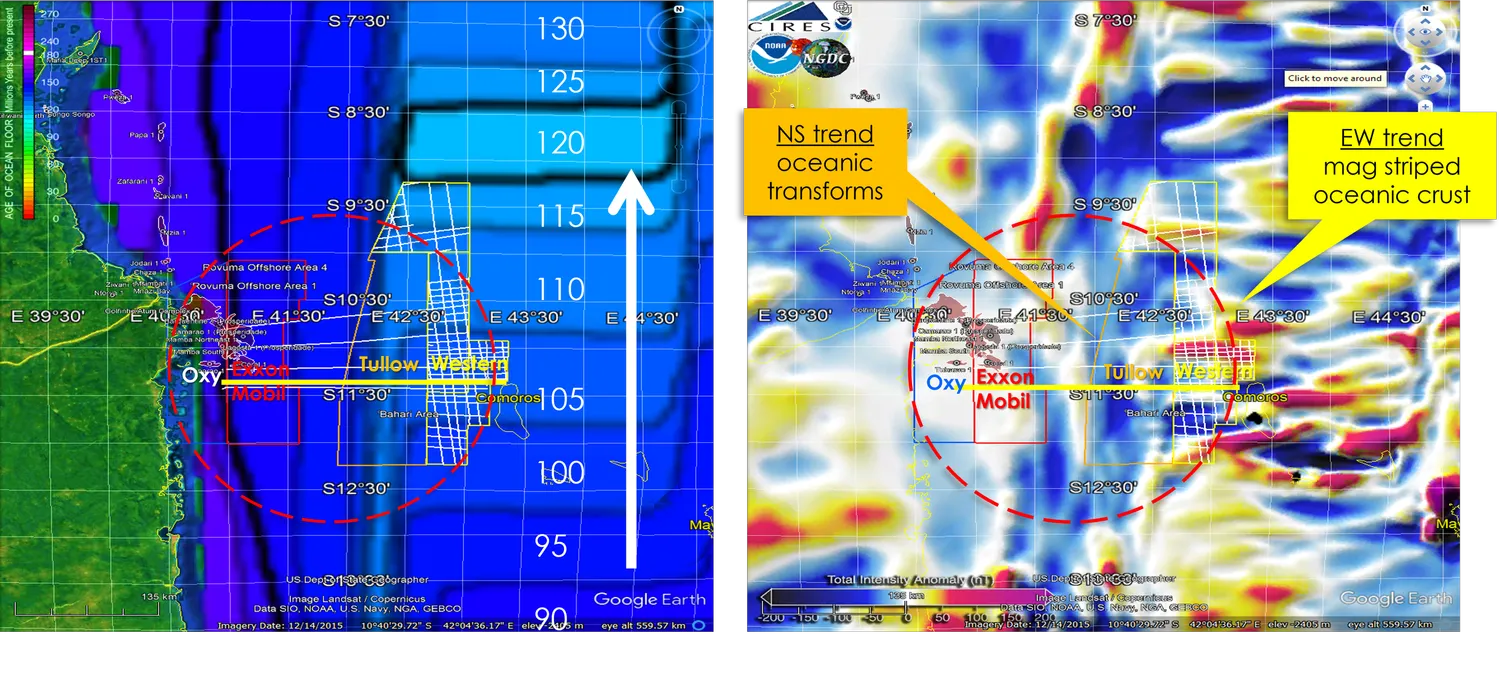
Left: age of ocean floor. Right: total-intensity magnetic anomaly, showing N–S oceanic transforms and E–W magnetic striping. Imagery: Google Earth / Landsat-Copernicus, SIO/NOAA/US Navy/NGA/GEBCO.
The basement below Comoros Blocks 35, 36 and 39 is Lower Cretaceous ocean crust with alternating east–west magnetic “striped” anomalies. Basement below the western Blocks 35, 36 and 37 is similar, but with well-developed N–S transform faults and fracture zones — some with 2.5 km of relief.
ION’s 2D seismic shows ocean fracture zones bounding the first sediments deposited on the ocean floor, of inferred Lower Cretaceous age. These units are inferred to be restricted lacustrine Type I source rocks and marine Type II source rocks; burial-history plots place them today in the oil window across all the blocks — a compelling basis for oil offshore the Comoros.
A modern analogue for the source rocks.
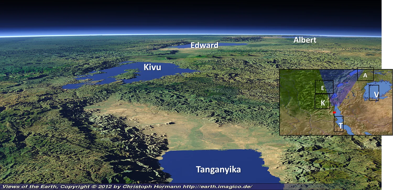
The igneous rocks in the Comoros and surrounding seas are younger — Miocene to present — coinciding with the onset of the East Africa Rift System, when asymmetric onshore rifts hosting deep anoxic lakes with Type I source rocks began developing. This is a modern analogue for the Late Jurassic rifting of Gondwana, when similar lakes formed in Somalia, Mozambique and the Weddell Sea Basin. These later became restricted marine basins after Lower Cretaceous seafloor spreading, with Type II source rocks deposited during anoxic events. Spreading ceased in the Aptian, with a third post-spreading anoxic event possibly in the Maastrichtian.
Comoros prospects range up to 700 km² in size, showing similar trends and geology in deepwater Tertiary turbidite fans above the Lower Cretaceous oceanic basement. Many are associated with surface oil seeps detected by satellite synthetic-aperture radar.
Considerable potential in these waters.
A Competent Person’s Report on Tullow’s Blocks 35, 36 and 37 estimated more than 7 GBO and 1 Tcf of non-associated gas as recoverable.
Source: Discover Exploration